Meet Today’s and Tomorrow’s Information Demands Through a Single Version of the Truth for Forest Assets.
Everything a Forest Management System does and much more!
Operating with Disparate Technologies Hurts the Bottom Line.
- Software from different vendors and architectures rarely function harmoniously, requiring excessive labor and training to operate.
- When Teams can’t easily use software in a way that works for them and their device, updates don’t make it in, creating operational gaps.
- Inadequate tech costs operations by through lost time and missed opportunities.
- Disparate technologies require constant attention to operate.
- Older technologies increase the risks ransomware and prevent organizations from innovations which save time, automate and analyze assets for financial gains.
The Digital Age is Here, are You Prepared?
- Are you handing the same information multiple times in different systems and need a better way?
- Is your business experiencing increasing information demands?
- Is it taking too long to get answers?
- Is there a feeling that important work is slipping through the cracks?
Gain an Operational Edge with a Single Version of the Truth for Forest Assets.
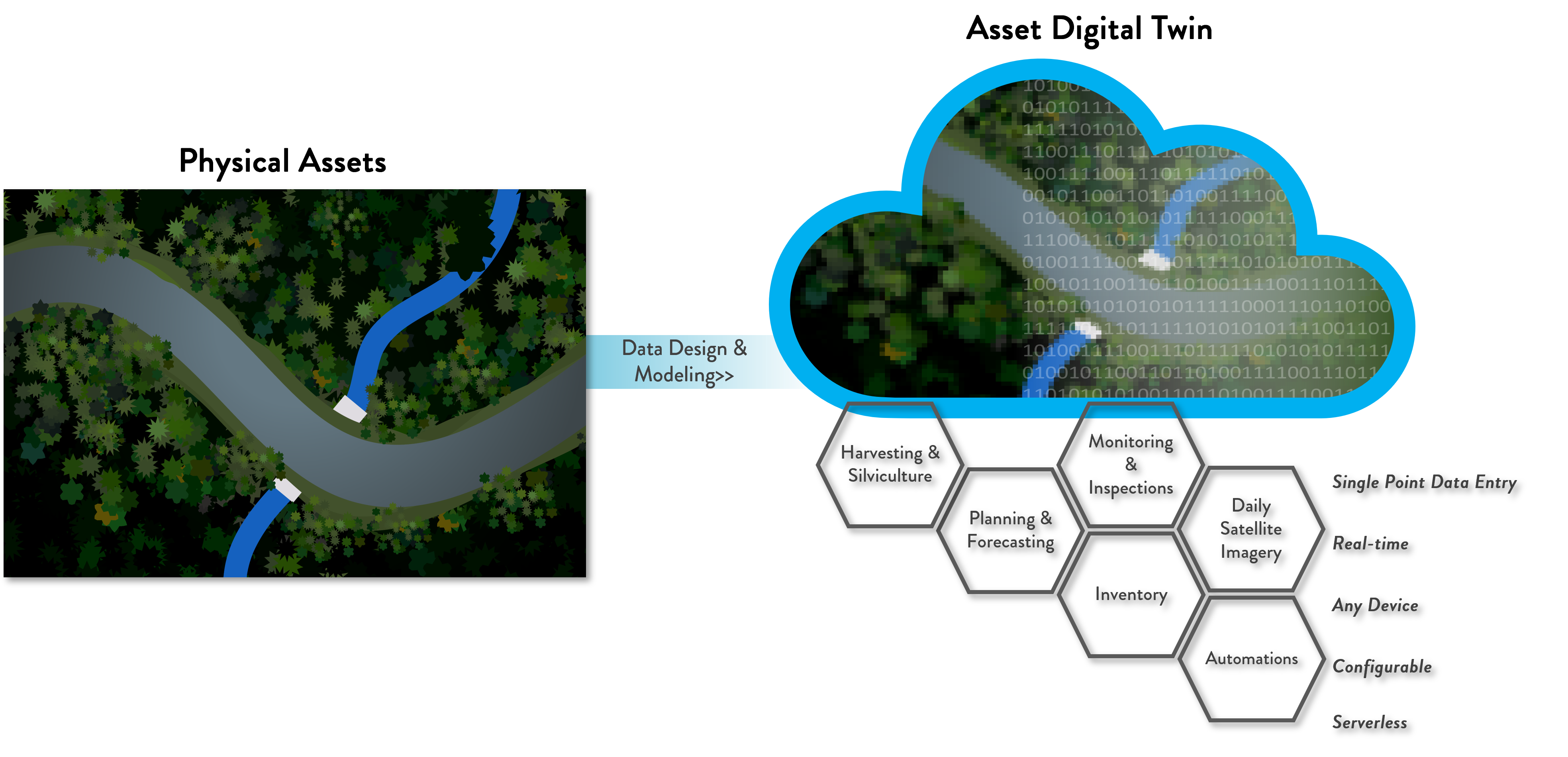
Web GIS Solution in Plain Language:
How is the Web GIS Solution Different?
- Automated workload and high velocity analytics means instant answers for everyone without file handling and manual updates.
- All components are actively maintained as part of Esri and Microsoft’s platforms to be up to date and operate disruption free over the long term unlike custom software when tends to go out of date and fall behind.
- Your data is not locked up in a custom application – it’s open to all device types, the web and desktop applications.
- More economical than custom software.
- Not a one size fits all – configure apps, maps and reports for the way you operate.
Land Records:
- Tract documents such as deeds searchable by tract names and in web apps.
- Access to up to date maps and land data by non-GIS users.
- Streamline county tax payment processes.
- Isolate mistakes tax bill to save tax expenses.
Friction-free Information Delivery for Everyone:
- Eliminate handling the same information in multiple systems.
- Science-based inventory methods which are defensible, repeatable and centrally managed.
- Reduction of lost time from one up to date version of tracts, stands, inventory and treatments accessible from wherever work is being done.
- More consistent, defensible answers to operational questions which come up every day.
- Automated answers for each level of the organization without having to wait for an analyst.
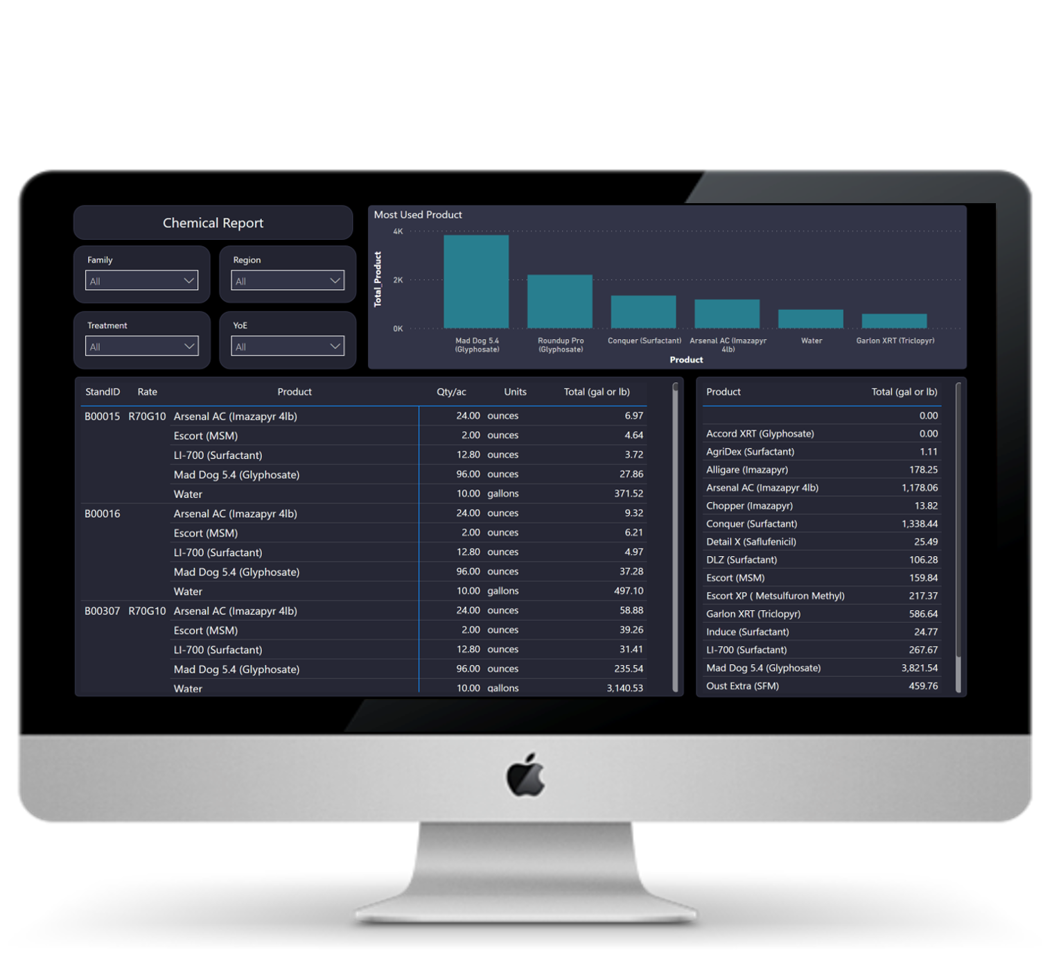
Chemical Prescription Amounts and Mixes based on Treatments Scheduled on Stands.
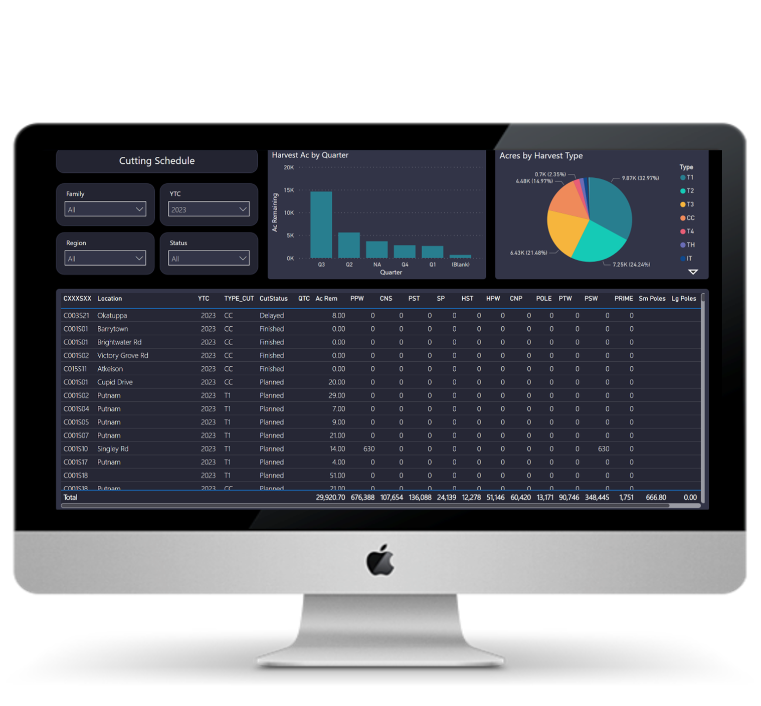
Power BI Cutting Schedule Reporting Directly from Web GIS – filterable by Year, Status and Operating Area.