Decrease your risk, simplify your operations, and take the hassle out of tech so you can get back to what you love to do
Forestry is a data-driven business, and most foresters know that the future is going to be even more digital.
The industry is changing to incorporate modern information systems and automation, while a younger workforce brings new expectations for technology and collaboration.
More and more, the lack of a solid technology strategy is going to hurt the bottom line and leave outdated companies behind.
Many organization don’t have the staff or IT resources to manage technology components like servers, licenses and databases. Our team provide organizations fully managed Esri web GIS in Microsoft’s secure Azure cloud. Some key features and benefits are:
- Modern, enterprise level capabilities without the infrastructure burden.
- Means to support complex field projects fast with configurable apps and web data services.
- High performance, high up-time of a commercial cloud.
- Standardization of data security, backups and redundancy.
- Elimination of onsite servers and maintenance.
Organizations of all sizes should have a strategy to leverage the commercial cloud. If you’re not sure where to start, reach out and talk to us to learn more.
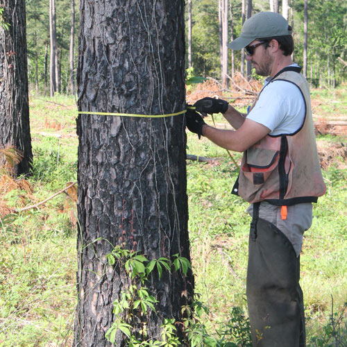
Our team has deep experience in every aspect of forestry inventory from setup, field work and reporting. If you need an inventory on your forest asserts to determine their value, reach out to us. There are a variety of ways which we can help you run an efficient inventory to capture decision ready data for land and timber assets.
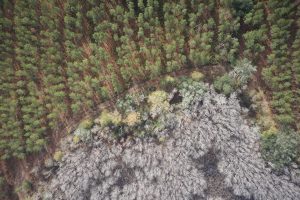
The mapping of tracts to determine land use, timber types or to quantify value or timber damage often requires recent aerial imagery. There are no shortage of individuals with drones that’ll say they can get you imagery. However, there is a big difference from the pictures or videos a consumer drone will provide compared to a professional UAS (unmanned aircraft system). The fixed wing UAS we operate can fly up to 1,500 acres a day with up to 3 centimeter pixel resolution. With this kind of georeferenced imagery we can support analytics and a variety of data outputs such as timber types and acreage, valuation and damage assessments. More advanced uses include phone or iPad accessible maps and normalized difference vegetation index (NDVI) for mapping vegetation health (damage or bug spots).
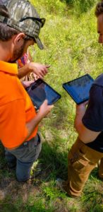
Can you update your treatments or enter new ones from wherever your working, or are you bound by an office system that requires you to write your treatments on paper to enter later? What if any time a client asked you when the last thinning was, or you wanted to know what the last stand treatment was, you could simply pull it up on your phone? Our foresters and our clients can see their forest treatments, on deck harvests and silvicultural treatments in real time and on any device. Reach out to us to learn more about how we can help you team work off a single version of the truth for your operations.

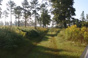
If you have substantial company roads, there are many advantages to be gained from assessing and analyzing these assets through a network analysis. Do you have woods roads which are absent or inaccurate in tools like Google Maps? Do you want to add new roads easily to manage their status and maintenance along with the rest of your roads assets? We have industry partners which wanted to use their owned roads data with phone based applications so everyone can see planning and maintenance information wherever they work. Often doing this begins with assessing suitability of current roads data to reveal any gaps and fixes needed to the data in routing, analysis, maintenance tracking and generation of directions.
Our team performs a variety of other technology and project services, including:
- Harvest Planning
- Timber Cruising Solution implementation from field hardware to cloud backend
- Forest Land Cover Mapping
- Geospatial Database creation and migration
- Environmental and ecological project support
- Senior consulting services for technology strategy, road mapping and needs assessments
- Property mapping