2023 Q1 Prism Update
We listen to your Prism feedback and the winners are in! Below are enhancements which aim to speed up data collection and eliminate friction points from the forest inventory business process:
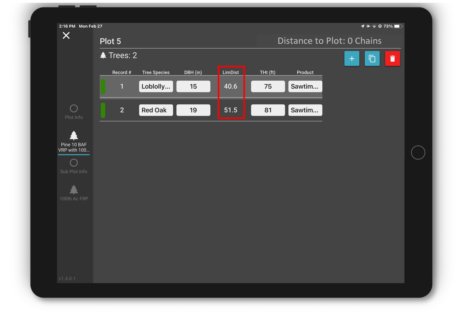
- We’re super excited to announce the mobile limiting distance tool. This tool indicates the distance from plot center to the face of a tree using tree DBH. On variable radius plots (prism cruises) this allows cruiser to quickly determine if a borderline tree is in the plot without having to consult a table. The limiting distance of a tree shows up – as shown in image below – after the cruiser enters a tree’s DBH. The limiting distance is written into the Prism geodatabase’s tree table. Please contact our team to quickly enable this feature during a time when there is a pause in your data collection. (released on Apple iOS and soon to be released for Android)

- Addition of a ‘none’ option for all mobile picklists. Before if a user picked a value from a list of non-required data there was no way to set the value back to a blank.
- Other minor fixes and usability improvements.
Other enhancements currently in development:
- Change cruise configurations (plot types and data collection methods) on the mobile devices without logging out/in (when connected).
- Support for more map symbology renderers to allow compatibility with Esri’s new map viewer and complex symbols such as those based on multiple criteria. Currently Prism maps support the ‘simple’ renderer which works from a single value in a map layer.
Tips to help you make the most of Prism in daily operations.
- Stick with the classic map viewer in ArcGIS Online if you’re setting up Prism layer symbology at the item level. This can be configured within Settings in ArcGIS Online.
- Setting Prism layer symbology in ArcGIS Online – Item – Visualization allows every map, apps like Field Maps and Prism to use the same colors and labels every time map layers are loaded. Setting symbols and labels on layer Items allows cruise maps to behave consistently for every user and every map.